Distance: 4.5 miles round-trip, 1200 feet elevation loss/gain
Hiking Time: Approx 2.5 hrs round trip
Driving Directions from San Diego on Google Maps (Click on link)
More information from "Afoot & Afield San Diego County: A Comprehensive Hiking Guide By Jerry Schad" available on google books (Click on link)
Our Trip: We planned to start off on the hike at around 9am, with 10 people in the group. However, due to various logistical reasons, we ended up leaving San Diego only at around 10am. We started off in two rental cars with 5 people in each. We had a quick stop in Ramona to get some subs and oranges for lunch. We reached the trailhead and started our hike downhill at around 12:40pm. The weather was excellent when we set out, around 60F and sunny.
We took our time walking downhill, stopping every few minutes to take lots of pictures of the wildflowers on the hillsides, and different species of caterpillars and beetles. Some of us saw a small 1-foot long snake that raced into a hole in the ground as we walked by. For the first mile or so, there is an excellent view of the valley through which the creek flows. Most of this section was exposed, but since the day was quite cool, we didn't feel anything.
Close to the bottom of the valley, we came to the point where the trail split between two paths that led to the bottom and top of the falls. If you follow the trail straight down, you reach the bottom of the falls. If you take the trail on the left, you go to the top of the falls. We chose the bottom path.
We took many pictures here and then sat down and had our lunch.After around 0.3 miles, we came across a "No Trespassing" sign, followed by a 3-way intersection on the trail. On the section of the trail heading straight ahead, we saw another "No Trespassing" sign that we assumed was part of private property. We took a left turn at this point towards the third direction where we saw a couple of other hikers emerge from. The trail crossed a couple of streams and went through some trees and shrubs to end at the base of the falls. There was a big pool at the base of the falls that was the origin for one section of the creek.
A family that had arrived at the falls just after we did soon started diving and swimming in the pool. Diving is officially prohibited due to the dangers of injuring yourself due to the shallow depth of the water as well as rocks on the pool floor (they didn't seem to care, however). The father and 3 sons were diving from some rocks on the side of the pool, while his 2 daughters were just generally swimming in the pool. The mother was taking pictures from the edge of the pool. (All above relationships are assumptions on my part, of course)
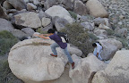
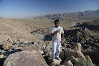
After lunch, we decided to get a bit adventurous and hiked up a steep path on the left side of the waterfalls to the top. It started off rocky and easy at the bottom, but got really steep towards the top with loose gravel and sand. Some people in the group had a little trouble, but we all got to the top in one piece. We got a nice view of the creek that became the falls. We saw a dead rattlesnake that smelled something fierce. Its body was still decomposing, but its head (and part of its body) was lying separately a few feet away, completely decomposed. We could see a few vertebrae too.
We hiked back to towards the main trail and joined it at the first fork, and hiked back uphill to the trailhead. In the end, our return hike was much faster than our onward one. We were back at the trailhead at around 4:40pm. We had a drink of water and started driving back to San Diego. We reached back home at around 6:30pm.
Pictures:
 |
| Cedar Creek Falls Hike |