Tuesday, September 16, 2008

Queen's Garden-Peekaboo 8 Loop

About the Hike: Moderate. Best times to hike is October. Spectacular thunderstorm vistas and cool weather.

Time: Total hike time = 4hr (+ additional time spent lunching)

Distance: 6.4mi round trip, 600ft elev change

Driving and other Info:
Shuttle to trailhead from visitor center

Our Hike: I think we chose the perfect day to hike this trail, of course it was extremely crowded for the same reason, but still well worth it. The trail takes you into the heart of Bryce Canyon, with other-worldly formations by your side as you walk along the trail. It is tempting to stray off the trail, but be careful about cryptobiotic soil and slippery conditions.

Monday, September 15, 2008

Emerald Pools

About the Hike: Easy hike, but maybe sandy and slippery. Best times to hike are during the Fall or Spring season.

Time: Total hike time = 1.5hr (+ additional time spent in the pool and for photos)

Distance: 2.9mi round trip, 600ft elev change

Driving and other Info:
In Zion national park, take shuttle

Our Hike: Very easy and pleasant hike, with a cool pool to relax your tired feet. Ideal hike to finish up a long day of hikes. We had done many small hikes in Zion and finished up with this one.

Friday, July 4, 2008

Mount Whitney Peak from Lone Pine

About the Hike: Extremely strenuous hike requiring ample preparation for high altitude physical activity. For those with acute altitude issues, the best approach is to hike this over 3-4 days, with sleeping altitudes (camping) at 8600ft (base camp/Lone Pine), 10400ft (Outpost Camp) and 12000ft (Trail Camp), and final summit (14500ft) on the 4th day. Weather conditions are icy and cold for most of the year. Best times to hike are during the months of July, August and September.

Time: Total hike time = 20hrs 10 min

Distance: 22mi round-trip, elevation gain: from 8600ft (trailhead) to 12000ft (trail camp) to 14500ft (summit)

Driving and other Info:
Follow I-215N to I-15N to 395N. The city of Lone Pine is the portal to the Whitney trailhead. Lone Pine is about 160mi up on state highway 395N north of the I-15/395 junction. Take the Whitney portal road 13mi west from 395 (turn left at the only traffic light in Lone Pine). Whitney Portal shop, trailhead and campsites are at the end.

Our Hike: In one word, gruelling. We learnt several lessons on how best to hike this mountain. Hat, sunglasses and sunscreen are very useful. We didn't sleep well at Trail Camp and this made our hike all the more tougher.Day 1 Start: 1.10pm, End: 8.15pm, hike time = 7hrs 5min;
Day 2 Start: 7am, Summit: 12.07pm, Start back: 12.30pm, End: 8:30pm, hike time = 13hrs 5min
Map of the trail.

Do
- Acclimatize properly (and slowly)
- Hike about 500-700ft above your sleeping elevation for any particular day
- Hydrate frequently (consume around 4L per person per day in 60-70F weather)
- Consume instant energy foods (e.g. chocolates) and salted foods (e.g. crackers, trail mix) frequently in small amounts
- Breathe properly, good deep inhales and exhales every so often
- Pack your gear in advance, planning for adequate but not overburdening amounts of food and gear
- Prepare for adverse weather conditions, with emergency supplies
- Leave all your camping equipment at Trail Camp while going up the to peak and pick them up on the way down

Don't
- Carry more than 2L of water. Water is available at plenty of locations on the trail and can be easily filtered. At higher altitudes, the snow-melt is pure and requires no filtering. More than 2L of water weighs you down.
- Assume that you can hike it in a short timeframe without proper acclimatization. You will not only have a bad experience, but also will regret not being able to enjoy the beauty of the sierras.

Pictures:

Mt. Whitney Peak Hike

Sunday, June 22, 2008

San Bernardino Peak

About the Hike: Strenuous hike with plenty of hiking in thinner air. Upper elevations are cool even in summer, though spring may require snow gear. Don't attempt the hike without proper training. Very similiar to San Jacinto.

Time: Start: 10.20am, End: 8pm, total hiking time = 9hrs 40min

Distance: 15.7mi round-trip, elevation gain: from 5500ft to 10600ft

Driving and other Info:
Follow I-15N to 215N to 10E, take the 38E highway to the Mill Creek Ranger Station. Trailhead is behind the fire station at Angelus Oaks. 126mi, 2hrs 11min from La Jolla.

Our Hike: Temperatures were soaring on the day we hiked this trail. The lower elevations are hotter, but also have plenty of shade, so the biggest problem in summer is bugs. This trail would be best in fall. Steep ascents for about 2 mi, then flatter to Manzanita Springs, followed by steep ascents again to Limber Pine and beyond. There are 3 peaks: San Bernardino peak, East San Bernardino peak and Anderson peak (also confusingly called San Bernardino Mountain). Our goal was to get to San Bernardino peak. Map for all peak locations. Preparation is key, just as with San Jacinto, i.e. good sleep, light lunch, small snacks and water along the way, ascending gradually after 9000ft. Once acclimatized, one can push oneself.

San Jacinto

About the Hike: Strenuous hike with plenty of hiking in thinner air. Generally cool in summer and fall, though spring may require snow gear. Don't attempt the hike without proper training.

Time: Start: 8.45am, End: 8pm, total hiking time = 11hrs 15min

Distance: 17mi roudtrip, elevation gain: from 6280ft to 10804ft

Driving and other Info:
Follow I-15N to 79S, left at 371, left at 74 and right at 243 to Idyllwild, the ranger station is on Pine Crest Ave. Follow Pine Crest and Fern Valley to the end to the top of Humber Park, which is the trailhead.

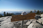
Our Hike: We did this hike twice. First time was faster, around 7.5hrs. Second time was slower, around 11hrs, mainly due to additional weight and lack of sleep the previous day. We learnt some important lessons on the hike: sleep well before, have a light lunch during the hike and climb gradually after 8000ft. The views are fantastic, but you won't enjoy it if you feel the effects of altitude, so prepare well. The path goes steep-flat-steep, so the last section to the peak is the toughest. The path is rocky and has tree roots cutting across, so watch your step.

Dripping Springs

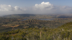
cloud cover over dripping springssouthwestern speckled  rattlesnakeAbout the Hike: Strenuous hike, mainly due to distance covered, elevation gain is not very taxing. Summers are too hot, preferred time is spring or fall. Vegetation coverage is limited initially, but gets more and more wooded later. It would be useful to wear protective (long sleeve) clothing or have a machete to prevent getting scratches from thorns / plants that grow into the trail frequently. Also WATCH OUT for rattlesnakes ! They are well-camouflages, and sometimes may be on the trail.

Time
: Start: 10.30am, End: 6.45pm, total hiking time = 7hr 45min (lunch 30min)

Distance: 6.8mi one-way on trail, 0.4mi along campground, total = 14.4mi, elevation: 1600ft to 4400ft variation

Driving and other Info:
1 hr (64mi) from La Jolla, http://backpacker.trimbleoutdoors.com/viewTrip.aspx?tripID=8492&mode=TripMap
http://www.etreking.com/eTreking/Pages/SanDiego.html

Our Hike: We started a little late in the morning, but were confident of finishing before sunset. The trailhead starts at a campground and we approached it going on 78E. There is a sign for "Dripping Springs" opposite the campground and trail. Contour maps help understand the trail's up and downs, so we armed ourselves with a digital pic of the trail map. We also had the map from the link above, which was surprisingly easy to follow.

Lunchbreak was around 2.30pm, and we had covered about 6mi, unsure of whether to continue or not. I think the lunch energized us enough to complete the hike, so we went till the trail ended at the Palomar McGee trail. The way back was rather eventful, we saw two snakes, includinga southwestern speckled rattlesnake, which was so well camouflaged, I didn't see it till I almost stepped on it on the trail. After that, our pace slowed a little, as we scrutinized shaded trail areas closely for snakes. We were back at the trailhead by 6.45pm.

Saturday, April 26, 2008

Henry W. Coe State Park - Burra Burra Loop & Kingbird Pond

Coe Backcountry Weekend: This is the largest state park in Northern California, and the second largest in the state (after Anza Borrego State Park in Southern California). For one weekend every year, the park opens up the gates at Bell Station entrance on Highway 152, east of Gilroy. The east side of the park has beautiful wildflowers and scenic trails, with breathtaking panoramic views of the Diablo Range. Entrance is by application only (chosen by lottery), and the number of cars each day are limited. All cars with 2-day permits are allowed to drive along the Kaiser Aetna Road till Orestimba Corral. We had a two-wheel drive vehicle, but we would strongly encourage anyone driving upto Orestimba Corral to consider taking a four-wheel drive - it will be worth it. There are wide & deep potholes, creek crossings and regular depressions on the dirt road beyond Dowdy Ranch. We got valuable info from the following sites:
http://www.coepark.org/
http://www.coestatepark.com/
http://www.broadsword.com/geocaching/CachingCoe.shtml

Driving Info: From the Bay Area, take US 101-S followed by CA-152 east at Gilroy. The Bell Station entrance to the park is located around 19 miles into CA-152, on the north side. Map of the location.

Burra Burra Loop
About the Hike: Starts and ends at the Dowdy Ranch Visitor Center. Easy hike with slight elevation gain and loss. During summer, expect to encounter lots of insects, ticks (beware of lyme disease!) and poison oak (look, but don't touch!). Temperatures were quite warm, but didn't affect us since the hike was very short. This hike offers good views of the Dowdy Ranch section of the park. The hike up to Burra Burra Peak is an optional side trail just before the hike starts going downhill.
Time: Start: 10am, End: 12pm; total hiking time = approx 2hrs
Distance: Around 3mi roundtrip; elevation gain: a few hundred feet

Kingbird Pond Hike
About the Hike: Starts and ends at Orestimba Corral. Intermediate hike with slight elevation gain and loss. Again, expect to encounter insects, ticks and poison oak. Make sure to carry lots of water as the day can get very warm. We went up the trail and looped back through the dirt road. We saw a lady who had to be driven back to Orestimba Corral due to heatstroke. This hike ends at Kingbird Pond which is a pretty little lake with several campsites around it, with a few families sitting around fishing and generally relaxing.
Time: Start: 2pm, End: 6pm; total hiking time = approx 4hrs
Distance: 5.5mi roundtrip; elevation gain: 780 feet

Pictures: The first part of the album has pictures from our hikes in the Park. On the way back from the Bay Area, we drove down on CA-1 (Pacific Coast Highway), and got a chance to take some nice pictures along the coastline.

Henry Coe State Park